
It is in the “weird stuff that won’t go away” file-as part of the trinity of the twentieth century approach to things, suburban Delta is home to the huge Port Metro Vancouver proposed expansion onto Class 1 farmland, the building of a mega mall again on Class 1 farmland, and just to round out the trio-a new bridge replacing the handy Massey Tunnel, again taking away farmland for the approaches.
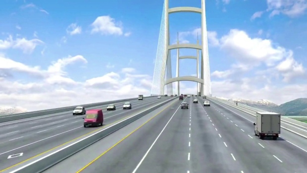
Price Tags has discussed the Massey Bridge at length. There has been some surprise that this bridge is being located again on the sensitive river floodplain, and in an area which has not been identified for increased density by Metro Vancouver.
Three months ago Metro Vancouver mayors rejected the project, because of environmental concerns and fears about the lack of a rigorous assessment process. The Mayor of Delta was the holdout, favouring the 3.5 billion dollar ten lane bridge that would take seven years to build, and come directly into that community.
And the reason for the bridge instead of the twinning of the tunnel keeps changing. Originally we were told the tunnel needed to be replaced to allow for the draft of ocean-going ships to access docks upriver on the Fraser. Then people in the region were told that the Massey Tunnel might collapse in an earthquake. After a solid rebuttal from Doug Massey, son of George Massey for whom the tunnel is named, the reason for the new bridge changed again-now it is to stop bottlenecking traffic.
Thankfully the City of Richmond’s Transportation Department produced a report this week that lays out a number of concerns about the George Massey Tunnel replacement project. As reported in the Richmond News, City Engineer Victor Wei ‘s report states
“there are significant gaps in the assessment of the impacts of the project, omissions of technical analysis as well as unsubstantiated claims of predicted project benefits.”
Sure vehicles will get over the Fraser River quicker, but what happens then? As Mr. Wei noted that the Provincial government “just see the Highway 99 corridor. They don’t seem to care about anything else”.
That is what others have been thinking too. There is little information on how traffic interchanges are being planned, nor what happens when all that free-flowing traffic gets to the four lane Oak Street Bridge. Lastly, Wei notes that the” Ministry has given varying forecasts of traffic for the new bridge. The report states the higher traffic volumes of 115,000 vehicles per day by 2045 are used to justify the need for a new bridge. Meanwhile the bridge can only expect to see about 84,000 vehicles per day by that time, if it is tolled (which it will be). “
The CBC notes that the City of Richmond is forwarding their report to the BC Environmental Assessment Office for review, at the same time as a series of open houses are being held regarding the proposed bridge. The Mayor of Richmond remarked that other cost-effective changes, such as public transit, banning semi-trailer trucks on the bridge at peak times, and (surprise!) building a second tunnel to ease congestion have not been thoughtfully considered.
If you want to have your say about this bridge proposal, there is one more open house scheduled for today. You can find information here from the Environmental Assessment Office of the Provincial Government on how to attend or how to write to get your views known. We need to approach this issue in a sustainable way as if agricultural land, public transportation mobility and the future of our region truly matters.


The heart wants what it wants. Don’t spoil it with facts.
After the traffic passes through the tunnel there are four busy exits before what traffic is left reaches the Oak Street Bridge.
The plan is to go from four lanes to ten. That is 2.5 times the capacity. Are you agreeing that the Oak St bridge will see 2.5 times the current volume, after those four busy exits each see 2.5 times their current volume? Or will it be less, which is to say we don’t need 2.5 times the current capacity?
As you would have noticed this morning and this afternoon, Jeff, there were substantial delays, to the point where vehicles of all sizes, were stationery, along both the south and the north approaches to the old tunnel. The congestion was horrible.
Fortunately there were no incidents because had there been the emergency responders would have encountered possibly life-endangering blocked routes. The exits and the open highways were clear and traffic flowed comfortably, including the Oak Street Bridge.
Only that old tunnel was congested.
I took note this morning of the traffic backed up northbound on 99 towards Oak Street. A queue lined up as far back as Alderbridge, 2+ km long. Like it is every day. It is facile to argue that the tunnel replacement is going to do anything other than move a few queues around.
Actually, the congestion will just have more room to grow with the 10-laner and all the expanded approaches and connectors. This is a well researched topic with examples from all around the world.
Two things have proven to relieve congestion far better than adding to the designated congestion space: More and better transit, and high fuel prices. To date, transit has been the bullied kid sister in a house full of big traffic engineer brothers who never passed out of adolescence. Until transit and human-scaled urbanism are given equal treatment to foster a more mature society, we’ll be stuck in a 1959 time warp riding in today’s version of Marilyn Munroe’s pink Caddy.
So you are saying that whatever traffic volume hits the Oak St bridge today, 2.5 times that volume will be fine, because the new Massey replacement bridge will be flowing comfortably.. Seriously?
No Jeff, it’s you that is saying there would, could or maybe might be 2.5 times the volume of traffic on the Oak Street Bridge, whereas the Massey Bridge is to relieve the congestion in the old tunnel about 7 km and five exits leading traffic off the road south.
The mistake you are making is that no traffic will go off on any of those five exits. Weird.
It is just math, Eric. If there won’t be 2.5 times the volume heading across the Oak St bridge, then it doesn’t seem like 10 lanes is justified. Each of those exits could also see 2.5 times their current volume as well, at the same time. Math.
Of course, eric is ignoring the point that there is no plan to address the increased traffic at *any* of those 5 exists. Steveston and No 5? “The City’s Problem”. Bridgeport? “Ask the City”. Knight Street? “It won’t be affected”. East-west connector? “Only a marginal impact”. We are spending $4Billion pushing queues around, with the road-building weflare recipients, Uh, I mean “contractors” rubbing their hands, knowing there will always be more “congestion relief” money in the future… and none of that messy referendum trouble.
Completely, well partly, agree with you this time Jeff, all those exits can handle the extra traffic, if there is any. Especially Steveston (by the way Patrick) which the plans show us is to be redesigned. Also, dedicated transit/HOV lanes between Bridgeport Road in Richmond and Highway 91 in Delta.
The big problem is the alternating one lane only going through the little tunnel. That’s where all the major congestion is and that’s why the bridge is wanted and required.
The ten lanes are needed when considering the mixture of traffic types and transit, trucks, etc., and all the smooth on ramps and exits.
I can see how Bridgeport could well be improved. It really has not changed for decades. Over those decades the airport has grown substantially, with YVR reporting almost double the number of passengers over the past two decades. Twenty years ago the hotel and casino were not there, neither was Costco and No.3 Road is growing quickly along both sides of Bridgeport.
“…all those exits can handle the extra traffic, if there is any. Especially Steveston…which the plans show us is to be redesigned.”
If there is any? There had better be, otherwise the business case for needing ten lanes on the bridge just evaporated. There should be about 2.5 times as much, in fact, in round numbers.
Let’s use the example of Steveston to illustrate the problem. With the redesigned Hwy 99 interchange, there will be eight lanes of traffic connecting to Steveston Hwy on the west side of Hwy 99. That interchange reconstruction will extend only to No. 5 Rd, at which point the roadway steps down to the existing four lane Steveston Hwy. From 8 to 4. Instantaneously. And your claim, Eric, is that the exit can handle the extra traffic. Do you have traffic models to support this bold claim? Actually, since you are suggesting above that the Oak St bridge won’t see additional volume, exits like Steveston Hwy will,have to take even more of the increased traffic, proportionally.
Recall also that the existing four lane Steveston Hwy does not have separated bicycle lanes. The project team hasn’t designed connecting bike lanes to the proposed bridge and new MUP, suggesting that municipalities can build them, to connect to the Bridge at Steveston Hwy on the north end. If you put protected bike lanes on Steveston Hwy, would you propose to find the space by taking away a current motor vehicle lane? It is hard to imagine that working out.
The bridge is to relieve the congestion. One lane morning and afternoon alternating is completely insufficient and the province in particular wants to see a dedicated transit lane available in both directions, all day long.
Whether there will be an increase in traffic is only something that some people can only imagine, although, with the obligation under the Metro Vancouver Regional Growth documents and plans, we can certainly expect more traffic and more bus riders. As well as cycle lanes in both directions too. Since, the southern municipalities have agreed to enlarge their populations, under the Metro Plan.
Are you suggesting the province should take away from The City of Richmond the responsibility for the design of Steveston Highway because Richmond is ignoring the needs of cyclists, and in so doing make it a provincial highway? If so, this will become a political issue between Richmond City council and the department of highways. Is your HUB group lobbying for this?
Eric: Look up induced demand.
And you haven’t explained how these exits will handle additional traffic volumes, despite the physical limitations of the connecting roadways.
Induced demand also applies to gaping holes in outlandish propositions; they strongly attract retorts.
Did the Dunsmuir Street bike lane create “induced demand” to the point where it’s overflowing and completely full every day?
Nobody needs to explain how exits will handle additional volume. The increased volume is all your idea.
The bridge is relieve the present congestion and facilitate transit and cyclists.
By the way. Why did you completely ignore the shortcomings of the City of Richmond, after lamenting the utter lack of provisions for cyclists on their Steveston Highway?
Eric, I didn’t ignore Richmond and their bike lanes. The topic is the Massey bridge. The Richmond bike lanes only matter in this conversation because the bridge will dump 8 lanes or 10 if you count the bike lanes, onto 4 lane Steveston Hwy and the bridge team expect Steveston Hwy to be the only connector to the new bridge for bikes. So if there is a new protected bike lane along Steveston Hwy those four lanes are at risk. Expect congestion. Which seems strange given your claim that the new bridge is designed to eliminate congestion.
OK, I’ll ask you again because it’s a jurisdictional issue. Do you want the province to take control of that road from Richmond because Richmond is not building sufficient infrastructure? Or, do we need to pressure Richmond to build up the infrastructure because the new bridge is going to bring a substantial increase in cycling?
Eric: ” I’ll ask you again..”
Why? I answered that the only reason Richmond is mentioned is due to the impact on local traffic.
It is an absurd question.
What I want is for the Ministry to live to its own published policies, and provide cycling infrastructure for the same scope as the highway improvements (from Oak St Bridge to Hwy 91). Dumping the bike traffic onto Steveston Hwy does not meet that obligation.
If MoTI want the bike route to run through Richmond because it is easier for them than putting it in the Hwy 99 right of way, then they need to approach Richmond, agree a route, and fund it. Similar situation exists on the south side of the proposed bridge by the way.
Now your turn. How does dumping 8 or 10 lanes onto a four lane local road relieve congestion? Same question for the Oak Street Bridge and all the other connectors.
You seem to be saying that after all your general comments the real issue is whether Steveston Highway has sufficient cycling infrastructure after the bike lanes on the bridge are in place. It sounds like you should be addressing your concerns to Translink and the City of Richmond.
There are grants available from the ministry for municipalities, on application, that wish to expand their cycling infrastructure. Richmond must be aware of this.
There’s also Translink. “TransLink is Metro Vancouver’s regional transportation authority. We are responsible for regional transit, cycling and commuting options as well as Intelligent Transportation System programs. Our services are delivered through our operating companies.
We also share responsibility for the Major Road Network (MRN) and regional cycling with municipalities in Metro Vancouver.”
The province is responsible for the Massey Bridge and is providing the cycling infrastructure as we expect. Will we see you there?
No, the real issue is that there will be significant congestion on all of the connectors to the new roads. When you dedicate space for cycling on those congested roads, it will be challenging.
The province is responsible for the new bridge, and the Hwy 99 corridor. They have their own published policy which requires that all of their road construction include cycling infrastructure. Up until now, that policy has not been followed on this project. There is no cycling infrastructure designed or costed along the corridor, ie north south, from the Oak Street Bridge to Hwy 91, apart from the MUP on the bridge. 3 or so km out of 24 in total. It would be good to see the policy followed. And to see less diversion and distraction.
Yes. It could be challenging if Translink and the City of Richmond doesn’t follow though and compliment the cycling infrastructure that the the province and Minister Stone have included.
There’s always room for improvement.
Even more challenging if the Ministry doesn’t follow their own published policy. Read it here.
http://www2.gov.bc.ca/gov/content/transportation/driving-and-cycling/cycling/cycling-regulations-restrictions-rules/cycling-policy
Why should municipalities pay for provincial responsibilities? Complimenting would mean connecting their local networks to the new overpass routes, for example. Not building the Hwy 99 route for the province.
I can understand your disappointment Jeff. Perhaps in a few decades and if cycling long distances does become the norm, then the government may well fund bike lanes everywhere. Obviously the primary users of the highway will be vehicles, including transit. Expenditures have to be carefully calibrated. Have your people estimated the extra financial burden for what you want included in this project? Are we talking about many hundreds of millions? We must bear in mind that some people want to scale back the project, whereas you want to expand it.
Oak Street bridge needs upgrading too as do Lionsgate bridge and Second Narrows. A growing regions needs more roads, tunnels, bridges AND rapid transit. More buses and bikes alone won’t cut it !
Where do you suggest will the additional cars go in North Vancouver? Tear down houses and businesses for wider roads?
removed because of content by editor
Sandy James writes that, [The Massey Bridge is to be built, ” in an area which has not been identified for increased density by Metro Vancouver.”
If you refer to page 68 of Metro Vancouver’s Regional Planning document, that was signed and endorsed, you will see that by 2040 Delta is projected to grow by 20%, or 20,000 residents, the population of Tsawwassen to grow more than 12 fold and from 300 dwellings to over 2,100. Further along the south of the bridge in parts of Surrey, and in White Rock we know that growth is anticipated by over 200,000 people. Leading east from the connection to Highway 10 and into Langley we see growth again projected at over 130,000 people.
We’re talking about almost half a million people in the areas served by this highway and this new bridge, as adopted by Metro Vancouver and consecrated under Bylaw No.1136,2010 of the Regional Growth Strategy.
I’d have to say this area most certainly has been identified by Metro Vancouver and that growth and increased density is coming.
The dedicated bus lanes on the new bridge are going to be needed.
Eric: Delta is expected to grow by 20% or 20,000 people … Tsawwassen to over 2,100 dwellings … White Rock to 200,000 people … Etc.
Wow! Megopolis here we come.
First, White Rock has 1/10th that estimate. And you skip over Surrey and include distant Langley which will be marginally served by the bridge at best. Your interpretation of the report to support Massey is suspect.
There is no comparison between the population and economic dominance of the Burrard peninsula, which will be poorly served by another unneeded freeway built in the farmlands, and better served by public transit. Justifying this massive project on population growth in communities south of the Fraser that are directly in its path is a joke with 1/3rd the population of the peninsula and less than 15% of the population of the Metro.
This is a white elephant in the making, and the supportive punditry have no clothes.
Half a million more people settling to the south and the south east, as agreed to by all the municipalities in Metro Vancouver and signed into law as the Official Regional Growth Plan is not chump change.
I did not skip over Surrey, I amalgamated the growth numbers just as shown in the Metro Vancouver (GVRD) documents. Remember too that Surrey Newton and South Surrey are closer to the Massey Bridge than they are to the Port Mann Bridge.
The project is not being justified by these projected numbers alone.
Well I’m pleased to see Richmond’s Transportation department agrees with me that, in the absence of increased capacity on the crossing, it will be necessary to ban some forms of traffic. :-). Strange that they would choose to ban trucks, rather than cars, given how important the movement of goods is to the region… Or maybe they understand the politics pretty well themselves…
Author
Reblogged this on Sandy James Planner.
Here we’re discussing a bridge that has no provision for public transit whatsoever–unless that public transit can be limited to the use of the road.
Does no one see a problem here?
Not only is there a lack of planning to offer any viable alternatives to the car, there seems to be a belief that we can spend and engineer our way forward.
This strikes me as being very similar to the public attitude of the 1960s, where every town and city wanted to “be like the Big City” –without defining what that actually meant, and without considering the consequences.
If we lose precious agricultural land, and even more precious wetlands, there is no way to achieve a sustainable urban environment. Similarly, if the car remains the apex of our planning and land use hierarchy, we will be in serious trouble.
The environmental footprint of the proposed bridge would be enormous, something not easily offset even if there was demand to build it.
It is almost as if our civic and provincial leaders have decided to put public transit last and agreed to never even talk about surface light rail.
The bridge is being built to a strength and with a design that can accommodate a rail line, should Translink decide in the future to build one.
This is included in the specifications.
So probably what should happen is that there be dedicated bus lanes on the bridge with all the ramps and stuff you would need for Skytrain and with some sort of separation from the other lanes then later in the future it’s all ready to replace with rail. Seattle did that underground downtown. It was like that for over ten years running buses and then when they got light rail it was easy to implement.
Without knowledge of the precise engineering I cannot say. But, I will say this. I have read and been assured by two principals on the project that there will be structural and spacial provision for rail, across the bridge, if that is what the Mayors and Translink decide.
There are lanes set aside that could be repurposed as Skytrain right of ways in the future. However, they arent just transit lanes, they are also HOV lanes so they aren’t separated. Along the highway they have merge points for cars, and at each interchange with a bus stop the lanes split so that buses take different lanes than cars.
Paying lip service to transit on the bridge in the plans and the PR spin is not an actual transit project. Dedicating space to transit doesn’t mean it will happen without political support. Just ask the folks who worked at Arthur Erickson’s office in the 70s and designed Robson Square with space along Howe St for a rapid transit line that, when it finally appeared almost 40 years later, was placed under the road allowance a block away.
The BC Libs are freeway builders first and foremost. They are planning and have built a total 20 bridge lanes and hundreds of km of associated highway lanes that went through funding and approvals like a tornado compared to the glacial pace of the single Evergreen Line, which cost 1/8th as much and probably uses 1/200th the amount of land by comparison. Rail will not appear on the Massey as long as they are in power.
Why don’t they build the bridge so it goes right over Richmond and ends up at Bridgeport Station. Oh tnat would bevRapid Transit.
That’s a good question Barb. The thing is there’s quite a busy exit now at Steveston Highway in south Richmond, where there’s a port facility to the east and the light industrial area around the west, where the BC Ferries works are and, of course Steveston itself. Then there’s another large light industrial and educational area off of the next exit at Westminster Highway, as well the main entrance to the city of Richmond, all the residences and retail and restaurants, as well as the hospital, etc., etc. Also, at this point on the highway is the branch to Highway 91 east that leads to New Westminster and Burnaby and the Knight Street route into east Vancouver and Port Vancouver.
It’s the next exit northbound that leads to Bridgeport, the retail, industrial and IKEA
and, of course the station, the River Rock complex and Vancouver International Airport.
Eric,
I don’t get your rationale. We need ten lanes now cause traffic is so bad. Traffic is going to get worse because of all the development south of the Fraser, more goods movement, etc. But, a ten lane bridge won’t increase congestion/volume at oak st or any other exit because traffic won’t get busier?
I don’t get how you want it both ways.
Let’s accept the fact that with ever more people in MetroVan and more commercial activity we need far MORE transit and road capacity. More bike lanes and buses alone won’t cut it.
We do not cost our high immigration. More immigration is better is the mantra. Is it ? We tax incomes far too high and properties and consumption far too little as we are stuck in 1950’s type taxation, growth, house price and interest rate model. We pay civil servants far too much ignoring longer life expectancies and risk of layoffs. Hence we have no money to pay for the required upgrades. As such, we need to tighten the salary&benefits of civil servants by up to 50% in some professions (some only 25%), up property taxes by as much as 100%, up PST say to 12% and lower income taxes, for example to 10% federally and 10% provincially, or of feds pay more for healthcare, say 15% federally and 5% provincially tops. THAT WOULD SPUR JOB GROWTH and tax revenue.
Immigrants with money do the right thing and declare incomes abroad and buy the biggest (undertaxed) house they can afford. This is not sound economics. THAT is the root of our problem. The effect is not enough money for transit and road/tunnels/bridges.
Don,
The traffic will almost certainly increase over time but the argument that everything is going to immediately arrive at the Oak Street Bridge is a supposition that does not take into account the other four major highway exits, plus the two other exits off the Oak Street Bridge that lead to Marine east and Marine west.
We hear it all the time. A big bridge will dump the traffic on to Oak Street. Well, no. It won’t. There are six exits that are well used and busy before any traffic arrives at Oak Street.
The bridge is being built to relieve congestion at that point along the Highway and to better facilitate transit and cycling.
Once dedicated bus lanes are in place and if Translink decides to increase service, maybe they will attract riders. This would reduce some vehicular traffic.
There are all kinds of possibilities. Translink might decide to improve connections at Oak Street around Marine Drive. They might improve Knight Street and that bridge. The CoV has big plans to continue the massive development around Marine drive Station (Marine Gateway). This means spreading south to Kent. How about east and the garbage transfer station? Is that going to stay there once thousands of new residents are in this new high-density district-energy neighbourhood? Is this what living in the Greenest City means; living next to a city garbage transfer station?
Right now the garbage goes on massive trucks, from the Kent facility then west on 70th, through the residential area then over the Oak Street bridge and down through the tunnel to garbage dump. The crows wait for the garbage trucks in the trees on 70th in Marpole, to catch the trucks as they crawl along to the the traffic signal.
We can be sure that this valuable land with water views will not remain as is. Neither will the whole area and its infrastructure.
No one said all the traffic was going to arrive at Oak St, that is your straw man. If the mix stays the same between the various exits there will be 2.5 times the capacity and thus potentially the same sort of volume increases, particularly at peak hours, so Oak and Marine could see those changes. Same with every exit from Steveston. At that exit we see eight lanes connected to the interchange on the west side, with no signals and highway speeds to that point. Then we get to a light at No 5 road and abruptly transition to 50 km/hr or less and only four lanes. One can imagine the queues backing up over the new bridge.
Eric, do you still want to maintain that all these local roads can handle the increased traffic just fine?
No one, Jeff. Here’s a collection of prominent suspects, assembled in about two minutes.
“In addition to environmental concerns, [Malcolm] Brodie (Mayor of Richmond) believes the bridge will shuffle traffic jams to the Oak Street Bridge.
– See more at: http://www.richmond-news.com/news/mayor-malcolm-brodie-a-bridge-over-troubled-finances-1.2319542#sthash.npmxf59v.dpuf”
“You’re going to come over that river faster, and then you’re just going to end up in that same traffic jam approaching the Oak Street Bridge that you’re always in,” said Richmond Mayor Malcolm Brodie. CBC.
” …it will simply add traffic pressure to the Oak and Knight Street bridges,” said Richmond Coun. Harold Steves [Richmond City Council]. – See more at: http://www.delta-optimist.com/bridge-battle-between-cities-1.2198856#sthash.RgDRCllq.dpuf
Metro Vancouver utilities committee chair Darrell Mussatto predicts the Oak Street Bridge will also end up a “very big pinch point” after the Massey bridge is built, and possibly the Knight Street Bridge as well.” Surrey North Delta Leader.
You asked me to look up ‘induced’, I ask you to look up your word, “potentially”. See the highway capacity, as you rightly call it, like a BC Ferry. They don’t always cast off full up. Do you want an absolute guarantee that the bridge will have 2.5 times more traffic on it than now before you will support it?
By the way, right now on the west side of the 99 at Steveston there are already about, what, 8 lanes. Two going south to the tunnel, one going east, two turning right on to No.5 Road and one going south on No. 5, then two more going west on Steveston. So you need not worry that the new configuration will really be much different, except for the lack of a few traffic signals, that will allow the traffic, and particularly the transit vehicles and the cyclists, to move more freely. In the case of the cyclists, as you pointed out before, as long as Richmond responds with necessary bike infrastructure to the massive anticipated increase in cyclists.
” what happens when all that free-flowing traffic gets to the four lane Oak Street Bridge. ”
Sandy James. Price Tags, above here Jeff. In the original article.
You did read Sandy’s article first, didn’t you Jeff?
The reason you like to build a strawman around the word “all” is that then you can say that some of the traffic could exit on those 5 exits, so it isn’t “all.” I just said it was about 2.5 times, in round numbers. Your traffic model may adjust that up or down depending on how the destination mix changes. What does your model show for increased volume reaching Oak St? Surely it isn’t still stuck on “none”?
Yes, the traffic could move more freely along Steveston Hwy. Until it hits the light at No 5 road, and the roadway gets reduced from 8 lanes to 4 lanes (without even considering the bike lane impact). No problem you say, the local roads can handle it. Does Richmond agree with you?
Should there be a guarantee that 2.5 times the traffic will pass over at peak periods? Well, that is another way of saying should there be 10 lanes instead of 4. And yes, we call that a business case. If there isn’t a guarantee, then there probably shouldn’t be 10 lanes. But a business case showing this would be a good way go garner support.
Again, Jeff, you seem to have an issue with comments from Mayor Brody, Councillor Steves, Mayor Mussatto and our very own Sandy James.
You are right that much of the traffic will have left the highway after the (actually it’s six) exits before Oak Street.
Remember too that the new buses will be going the length of the project, from Bridgeport Station all the way south to the 91 in Delta, along new dedicated bus-only lanes. These will certainly be busy and relieve many commuters from their private vehicles, further reducing blockage on the Oak Street Bridge.
There is no guarantee that any specific volume will pass over the bottleneck and the area where we now see daily chronic congestion. Both sides of the river have major connecting highways to cities, industrial areas, transportation hubs at Canada Line Bridgeport and the BC Ferries main terminal and the growing Tsawwassen First Nation residential and commercial developments.
It’s no wonder that both polls, Insights and the on-line Daily Hive (Vancity Buzz) show overwhelming two thirds support for the building of the new bridge.
Eric you didn’t address my point. I don’t care what other people say about oak st. What you’re saying is we need this bridge to address current and future congestion but building that bridge won’t have any impact on the rest of the exits and local roads.
How do you square that argument?
Don – The bridge may well reduce congestion on the other exits because there will be dedicated bus and cycle/pedestrian lanes.
This is what happened after the new Port Mann Bridge was completed. Alon Weinberger of Evolve Traffic Solutions studied this and found that, “ridership projections for this route have been exceeded year after year, and it became a very popular route, taking many vehicles off the highway”.
Another thing to consider is that the suggestion that the construction of the new Port Mann Bridge would have caused increased and massive congestion along 1st Avenue by Rupert Renfrew and Nanaimo Streets, that being the primary entrance to downtown Vancouver. This did not happen. What the construction of the Port Mann Bridge did was relieve the chronic traffic bottleneck that was the old bridge, with the bonus being the ability of transit to flow freely across the river at that point.
There is, as in all major political projects, both factual and emotional differences of opinions and some of these are philosophical.
It is somewhat weird to hear voices calling for retaining a structurally aging one-lane tunnel with dangerously filthy air inside as the primary connector from Vancouver to the main provincial ferry terminal, the USA, the port facilities and the substantial southern municipalities of the region. The bottleneck must go.
http://adammclane.com/wp-content/uploads/2011/12/bottleneck_diagram.jpg
I’s not all SOVs.
http://www.evolvetraffic.com/wp-content/uploads/2015/07/Massey-Tunnel-Congestion.png
If you are going to quote Evolve Traffic Systems, perhaps take a look at some of the nuggets on their web site:
“The best traffic solutions may sometimes produce results that were not anticipated. A small project with a minor increase in traffic can create a ripple effect on the area road system…”
“People travel through municipal boundaries, use local or provincial roads, and sometimes use more than one transit system. Working in a “bubble” does not yield good long term results”
These are the points being made, Eric, which you are denying. Increases in traffic (ie on 99) can create ripple effects (ie on exits and local roads).
The new bridge can’t be implemented in a bubble. It needs to be integrated, and this requires cooperative planning with the regional authorities, in this case Metro and the municipalities.
And more from Evolve, with a comment on potential Massey Tunnel replacement traffic jams:
“I read an article on Monday discussing some of the concerns arising from the upcoming replacement of the Massey Tunnel. One major concern which has been echoed in this article by Malcom Brodie, the Mayor of Richmond, is that the new Massey Bridge will simply shift the traffic jam from the Massey Tunnel onto the next narrow crossing, the Oak Street Bridge. The mayor is absolutely right: The traffic jam will simply move north. How do I know? Because it has happened in every road/bridge upgrade in the Lower Mainland.”
The author goes on to say that the benefits came from implementing rapid transit.
I can’t keep up with you, Jeff. Yesterday you said, “No one said all the traffic was going to arrive at Oak St, “. Now your quoting His Worship the Mayor of Richmond saying this!
Yes, the benefits come from implementing rapid transit in conjunction with TransLink and the Canada Line hub at Bridgeport Station. Rapid Bus Transit will be implemented on the Massey Bridge linking to the Canada Line and the Vancouver Sky Train system.
There are many commuters looking forward to the new Rapid Bus routes and many cyclists looking forward to this new bike crossing to Delta and Tsawwassen, I’m surprised you don’t seem to be one of them.
Eric, your inability to keep up is self induced. You keep getting asked the same question, and to avoid answering it you keep diverting to new topics. Yes, keeping up could be hard when operating that way. Or, you could just answer the question.
BTW, the mayor didn’t say all. That is your word. Unless you can show a traffic model with a new traffic distribution, how about we just use 2.5 times, at peak periods. At each exit, and at the termini.
And it will be easier to get excited about the bike crossing when it is designed (and funded, and built) to go to places like Delta and Tsawwassen. Right now it is just proposed to go to River Road. Even though the project runs to Hwy 91. And only to Steveston Hwy on the north end, even though the project runs to Bridgeport Rd.
Eric: “Yes, the benefits come from implementing rapid transit…”
Now you’ve got it.
Don’t worry Jeff, Oak Street, nor the other exits, won’t get 2.5 times the traffic, even though you seem to be fixated on it. Once the transit is running we will probably see a reduction in traffic, as happened on the Port Mann. Except bikes. They will increase beyond possible measurement, since now they cannot go through the old dangerous and fumes filled tunnel.
Glad you are in agreement.